
Improving Predictions
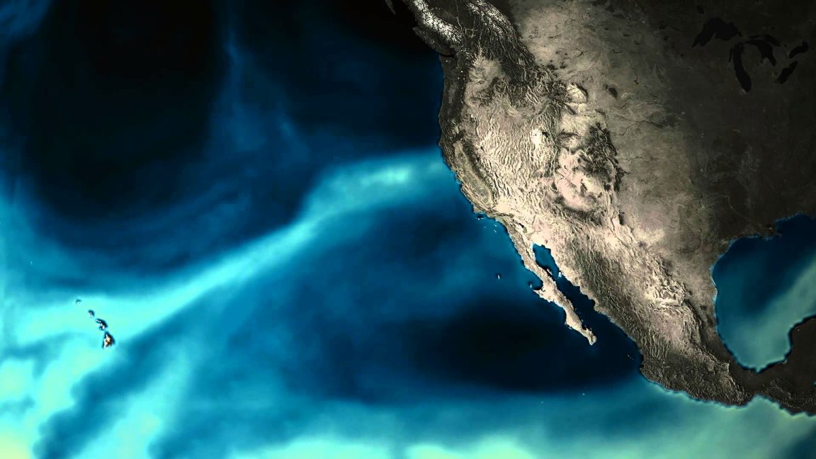
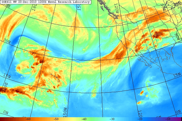
Atmospheric rivers are long, narrow pieces of the atmosphere that appear like ribbons of water vapor traveling from tropical regions. When they arrive over land, they usually result in rain or snow, making them an essential water source for otherwise deficient areas like Southern California and other drought-ridden regions.
While these rivers are vital to survival and water collection, they can also cause mass flooding in these west coast communities. Given that they can bring about natural disasters, being able to predict when the rivers will make landfall would be of great help. Presently, we’re only able to predict them about two weeks in advance.
Hoping to improve those predictions, which would give communities more time to prepare, a team of atmospheric scientists at Colorado State University (CSU) developed a model that can predict atmospheric river activity up to five weeks in advance. The study, published in the Nature Partner Journal Climate and Atmospheric Science, is part of an initiative funded by NOAA Research’s MAPP Program and used the team’s careful analysis of 37 years’ worth of weather data.
Whatever the Weather
Cory Baggett, a co-author of the paper and postdoctoral researcher, said the model is “impressive,” considering that even NOAA’s state-of-the-art forecasting system and other models elsewhere in the world can only make such predictions, at most, a week or two ahead of time. Many lives could be saved if local emergency crews and reservoir managers had more of a lead time to prepare for extreme weather events, like droughts or heavy rainfall, that atmospheric rivers can bring about.
While preparing for potential natural disasters is an important benefit of the model, the team also noted that it could improve even routine weather reporting — meaning it could help communities feel better prepared whatever the weather may be.