
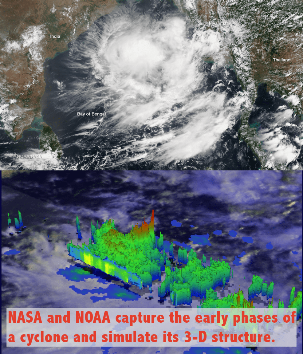

A serious storm is brewing in the Bay of Bengal between India and Thailand. The Joint Typhoon Warning Center warns that the tropical cyclone pictured above may develop into a full-blown typhoon over the next day. Hurricanes and typhoons, which differ only in their locations, earn their names by achieving winds speeds over 74 miles per hour. This storm will remain dubbed “System 92B” until that threshold is passed. Heavy rains and thunderstorms are already underway, while the curved convective bands seen above continue to develop.
On May 19th and 20th, 1-2 days before the image above, System 92B was imaged by NASA’s Tropical Rainfall Measuring Mission (TRMM) satellite. TRMM’s Precipitation Radar (PR) measured rainfall rates upwards of 1.5 inches per hour on the 20th, and the data were used by researchers at NASA’s Goddard Spaceflight Center to simulate the 3-dimensional rainfall structure. A simulated flyby is shown in the GIF animation below, showing storms that reach over 8.5 miles into the atmosphere.
