
Terrifying Tornado
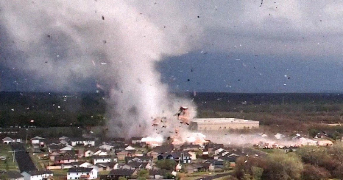
Terrifying new drone footage shows a massive tornado leaving a devastating trail of debris behind in Andover, Kansas.
The crisp high-definition video, making the rounds on social media today, shows the tornado first form in spectacular detail — and then show off its horrifying destructive power.
“Note how the tornado propagates via vortex dynamics and likely terrain,” meteorologist Reed Timmer wrote in a tweet accompanying the video. “Incredibly, no lives were lost by this tornado.”
Path of Destruction
The raging twister, one of an estimated 15 in the area, leveled dozens of structures in Andover late last week, according to CNN. It was rated an EF-3, meaning it was pretty serious, with winds reaching speeds of between 136 and 165 mph.
“I just couldn’t believe,” local resident Alaina Adkins told CNN. “It just didn’t look real.”
Supercell Dweller
According to the US National Oceanic and Atmospheric Administration (NOAA), tornadoes form after winds blow in different directions at different speeds, first forming a large thunderstorm. Inside this thundercloud, also known as a supercell, hot and cold air currents can result in spinning air currents.
Tornadoes have been known to reach 300 mph, even stripping asphalt off roads.
While scientists are getting better at predicting tornadoes thanks to detailed satellite and radar imagery and computer forecasting models, the violent storms can still be surprisingly unpredictable, especially when it comes to anticipating where they’ll go next.
It likely won’t be the last devastating tornado season experienced by the Midwest, either — in part due to climate change making extreme weather events like it increasingly common.
Updated to remove incorrect references to the storm as a hurricane rather than a tornado.
More on tornadoes: Tornadoes Like Kentucky’s May Be Getting Stronger Due to Climate Change, Scientists Say