
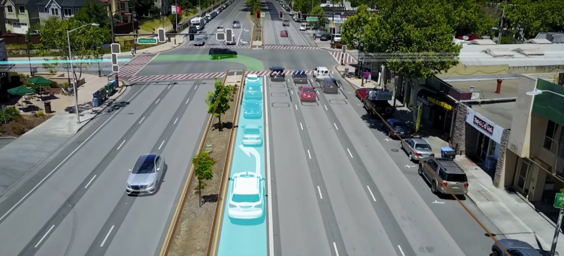
If you’ve ever wondered what the road looks like through the eyes of an autonomous vehicle, now you can find out, thanks to this video from Civil Maps. The video depicts what a self-driving car perceives using its sensors and the information it processes through its on-board computer. Civil Maps, Ford’s HD map technology company, created the video, which also shows how detailed 3D maps is combined with sensor data from radar, optical cameras, and other on-board vehicle hardware to help an autonomous vehicle understand what’s going on in the world around it.

The video shows how the car responds in use, taking things like a pedestrian crossing into account without slowing down too much, and processing messages from signs without “overthinking.” (For more on this from Anuj Gupta, the product manager for Civil Maps, see his post on Medium.)
The video also shows the car using the mapping and localization tech at higher speeds of up to 113 kph (70 mph) on a freeway, providing a fairly convincing case for the tech. As early data suggests that self-driving cars are safer than those driven by humans, this kind of autonomous driving tech could be used to make commuters safer.