
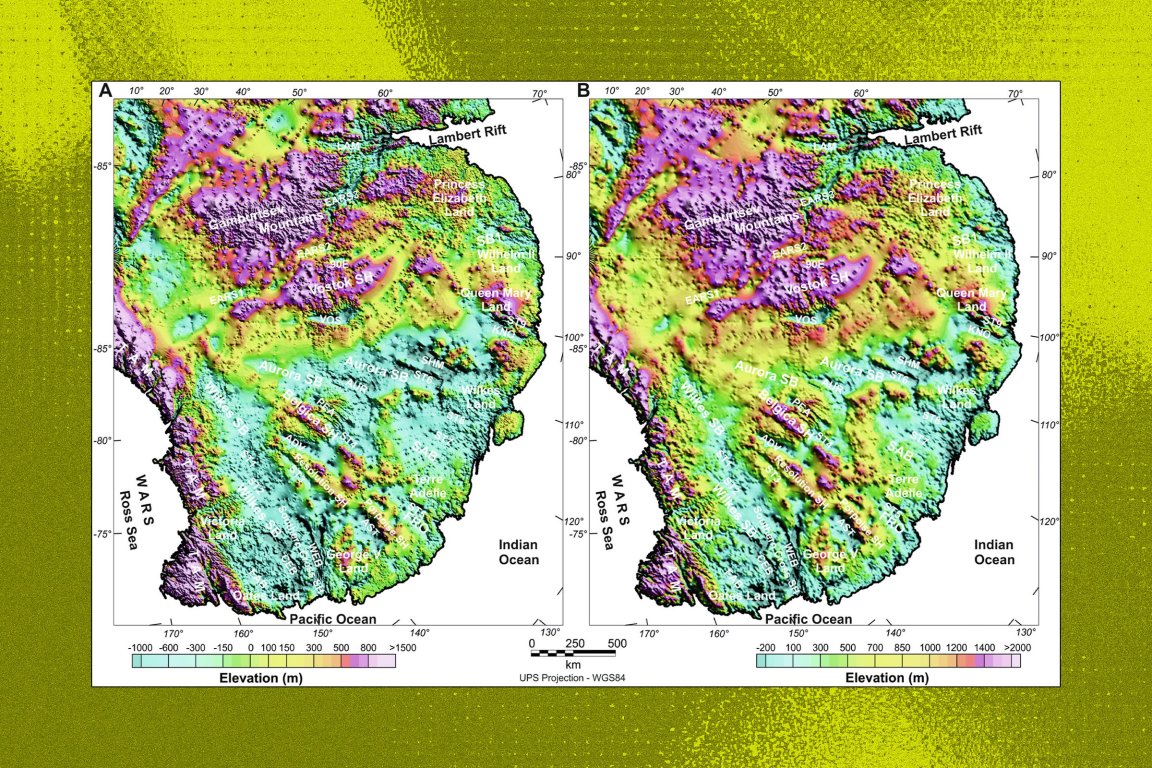
Researchers have uncovered the existence of a monumental geological structure buried two miles beneath the frigid ice of Antarctica.
According to a new paper, published in the journal Nature, the massive structure is made up of several previously known glacial landforms, like the Wilkes and Aurora subglacial basin region of East Antarctica, as well as Lake Vostok, the largest known subglacial lake on the planet.
These features have been studied separately for years, a press release notes, but have never been recognized as individual pieces to a larger puzzle.
Called the East Antarctic Fan-shaped Basin Province, the newly-identified structure likely represents one of the largest Earth features of its kind. While more work will be needed to corroborate the findings, the theorized formation could be crucial for understanding how Antarctica came to be, and how its three major ice sheets may respond to a warming climate.
To map the structure, scientists compiled datasets from a buffet of sources, like geological observations, gravity measurements, magnetic data, and models of the Earth’s crust, among others.
Added together, those datasets led researchers to conclude the geological feature likely formed through a process known as “distributed rotational extension,” where continental crust slowly stretches outward from a central point over a period of millions of years.
“Because these basins underlie about half of the East Antarctic Ice Sheet, they are likely to heavily influence both ice-flow and landscape evolution, making them essential to Antarctic glacial and hydrological processes,” the study’s authors write.
More on Antarctica: Scientists Scramble to Set Up Outpost on Rapidly Melting Glacier