
Crab in the Dark
Scientists at the Monterey Bay Aquarium Research Institute (MBARI) have created a stunningly detailed seafloor map of the largest submarine canyon off of the US Pacific coast.
Using sonar data collected by submersible research vessels, researchers created a “centimeter-scale resolution” of the “deep-sea Grand Cayon,” shedding new light on how it’s constantly evolving.
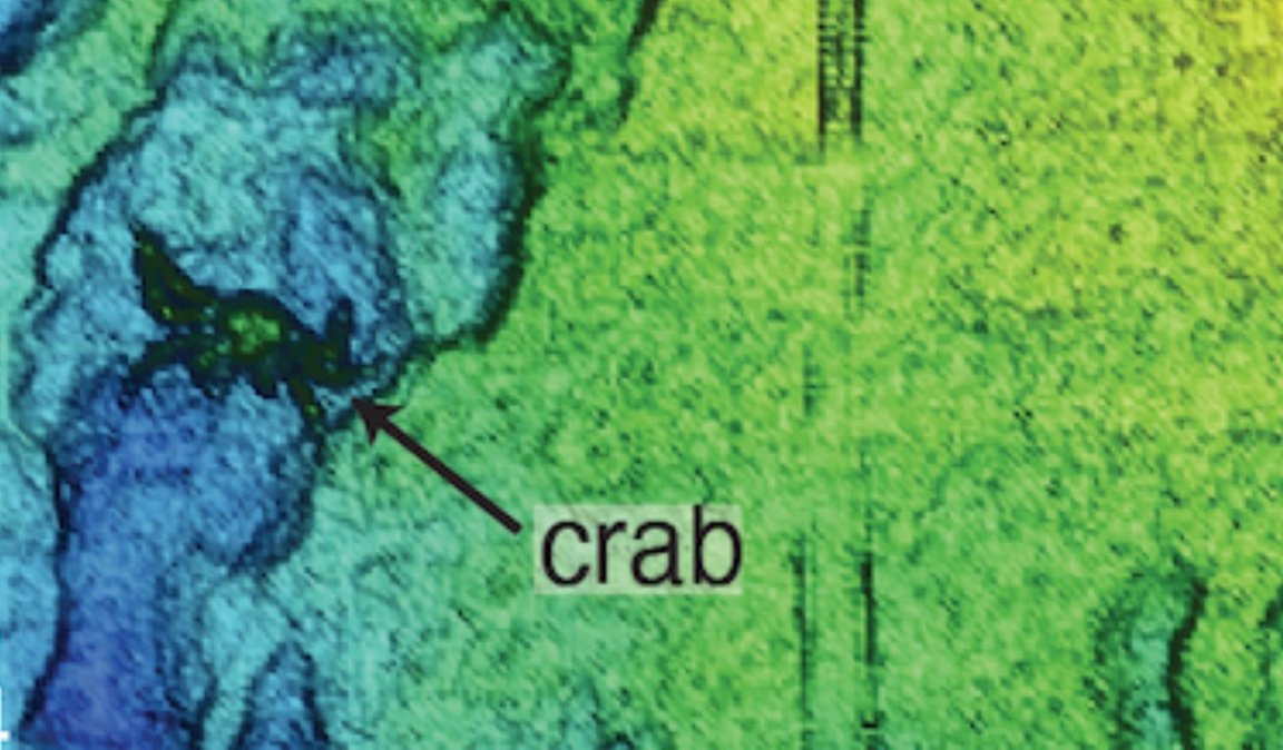
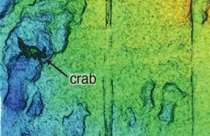
The resulting map of the 7.5 miles-across underwater ravine, which extends to a depth of 2.5 miles below the surface, is so detailed that an individual crab can be spotted. Hi crab!
Underwater Avalanche
The Monterey Canyon formed over millions of years as sediment slumped due to “storm waves, vibrations from fault activity, and random failures in the canyon walls,” according to a statement, in what amounts to an “underwater avalanche.”
And as it turns out, thanks to frequent oceanographic mapping, scientists have discovered that these events occur multiple times a year, and can even bury scientific instruments in the process.
“Repeated mapping surveys have given us a valuable new perspective to study the processes that sculpt the canyon,” said Monica Wolfson-Schwehr, previously a postdoctoral fellow at MBARI and lead author of a new study about the scan published in the journal JGR Earth Surface, in a statement.
“This is vital context for understanding not only life on the ocean floor but also how the underwater infrastructure that we depend on may be vulnerable to underwater landslides,” she added.
Crab Spotting
The data that was picked up by sonar instruments attached to remotely operated vehicles has such a high resolution, it can even show 3D objects, “including living animals with soft tissues,” according to the statement.
That makes this map “particularly useful for ecological studies,” MBARI principal engineer Dave Caress explained.
It’s a tremendous wealth of data that paints an eerily realistic and ever-changing picture of a particularly active underwater landscape.
“As technology advances and we can map at finer and finer resolutions, we can observe a new level of complexity in the seabed,” Wolfson-Schwehr said. “We don’t realize how much of the picture we’ve been missing.”
More on seabed: Scientists Discover Leak in the Bottom of the Ocean