
China’s Own Compass
GPS has been an integral part of modern living, integrated in our cars, our smartphones, even our homes. And its steadily getting better, more accurate, and more widely available. And the Chinese government is now working on its own version of GPS.
And they’re getting there.
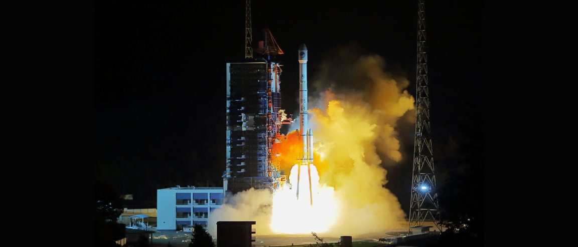
China has just launched the 23rd satellite in its BeiDou Navigation Satellite System (BDS), the Chinese answer to the GPS. A Long March-3C rocket, carrying the BeiDou-2 Compass G7 spacecraft, blasted off from Launch Area 3 at the Xichang Satellite Launch Center last June 12.

BeiDou-2 Compass G7 belongs to the second generation of the BDS, also known as the Compass Navigation Satellite System, is designed to provide continuous, real-time passive 3-D geo-spatial positioning and speed measurement.
The satellite is fitted with a laser retroreflector for precise orbit determination, a phased array antenna for the transmission of navigation signals, a C-Band ranging antenna, and also an S/L-band dish antenna. The spacecraft is expected to offer its services for about eight years.
Long in the Making
Chinese satellite navigation ambitions are not new. Their BDS system started since the year 2000, as the BeiDou-1, more of a experimental regional navigation system composed of four satellites.
Now, the next phase, BeiDou-2, will be a constellation of 35 satellites, which include 5 geostationary orbit satellites for backward compatibility with BeiDou-1, and 30 non-geostationary satellites that will offer complete coverage of the globe.
The BDS is designed to achieve similar performances. The network will have a dual use: a free service for civilians, and a licensed service for the Chinese government and military. The civilian service will provide an accuracy of about 10 meters (33 feet). The restricted military and authorized users’ service will provide higher tracking accuracies of 0.1 meters (0.33 feet).